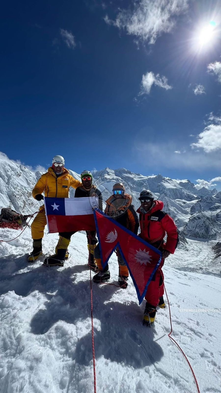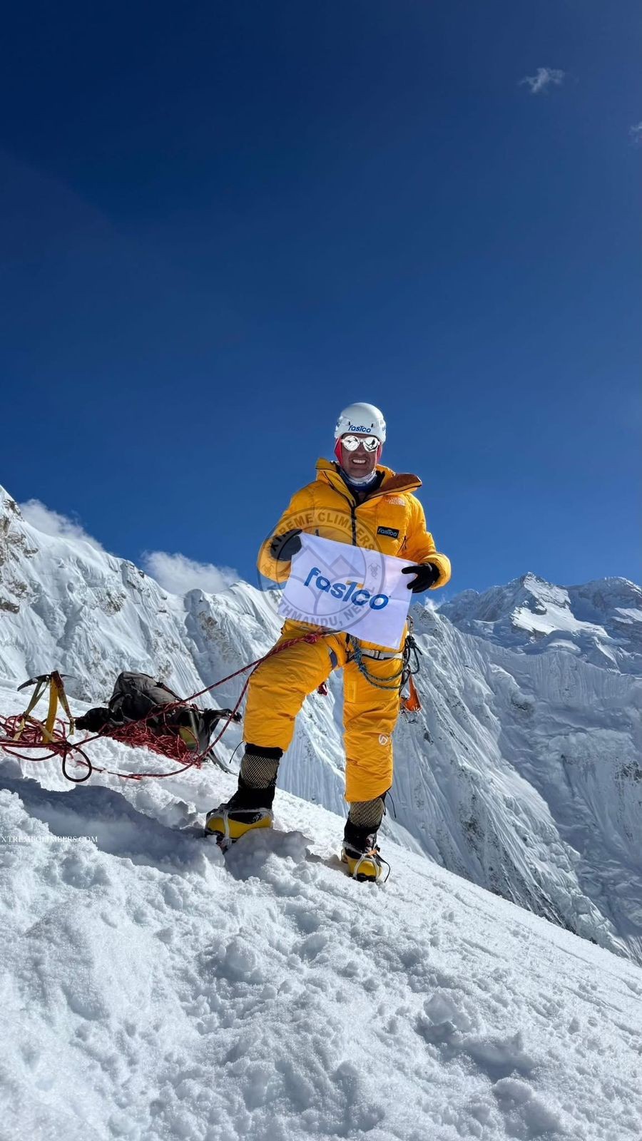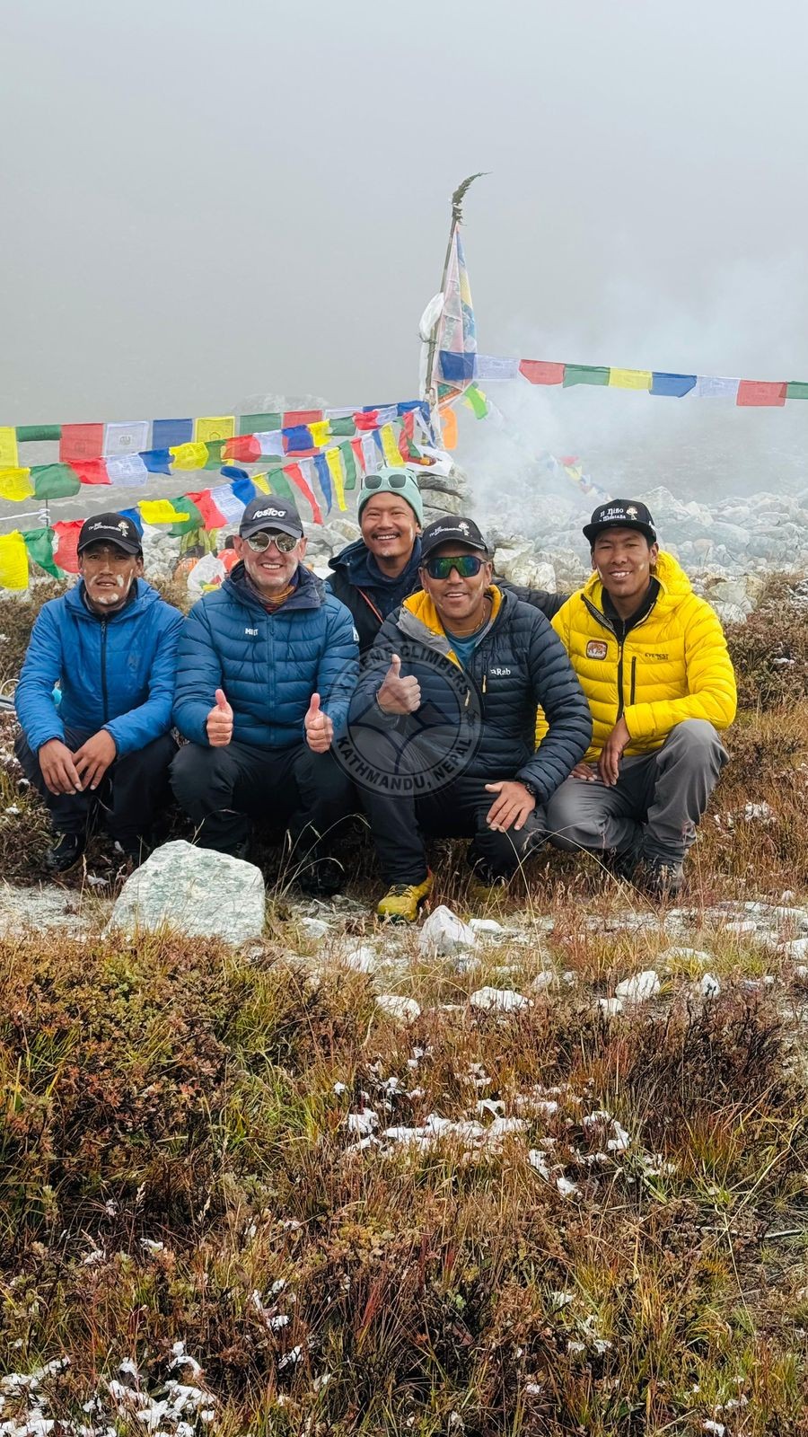


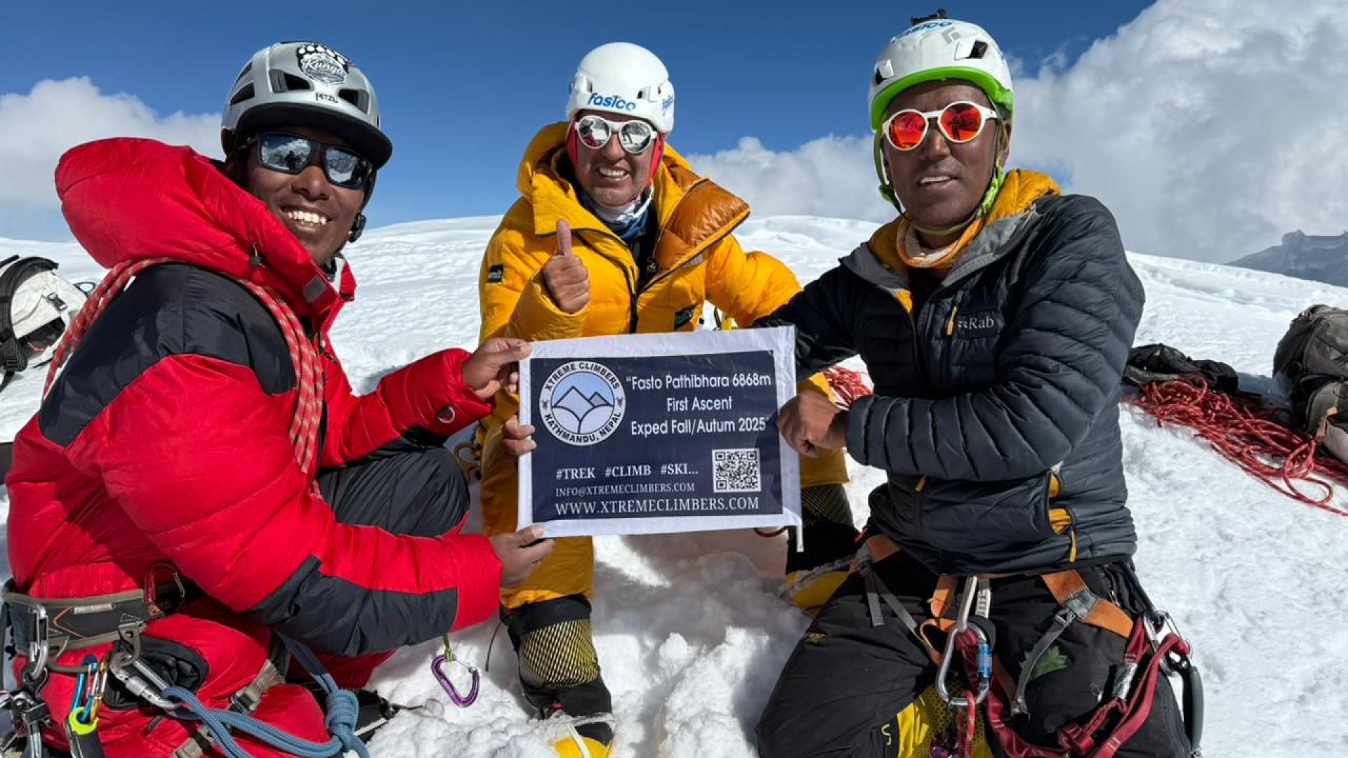
𝐗𝐭𝐫𝐞𝐦𝐞 𝐂𝐥𝐢𝐦𝐛𝐞𝐫𝐬 𝐓𝐫𝐞𝐤𝐬 & 𝐄𝐱𝐩𝐞𝐝𝐢𝐭𝐢𝐨𝐧𝐬 𝐏𝐯𝐭. 𝐋𝐭𝐝. proudly announces the successful first ascent of 𝐌𝐨𝐮𝐧𝐭 𝐏𝐚𝐭𝐡𝐢𝐛𝐡𝐚𝐫𝐚 (𝟔,𝟔𝟖𝟔𝐦), 𝐒𝐨𝐮𝐭𝐡-𝐄𝐚𝐬𝐭 located in the Kanchenjunga–Taplejung region of Eastern Nepal. The historic ascent was achieved on 𝐎𝐜𝐭𝐨𝐛𝐞𝐫 𝟏𝟒, 𝟐𝟎𝟐𝟓, 𝐚𝐭 𝟏𝟑:𝟓𝟎 𝐡𝐫𝐬 (𝐍𝐞𝐩𝐚𝐥 𝐓𝐢𝐦𝐞) by a fi ve-member international climbing team under the leadership of 𝐌𝐫. 𝐇𝐞𝐫𝐧á𝐧 𝐃𝐚𝐯𝐢𝐝 𝐋𝐞𝐚𝐥 𝐁𝐚𝐫𝐫𝐢𝐞𝐧𝐭𝐨𝐬 𝐨𝐟 𝐂𝐡𝐢𝐥𝐞.
This ascent marks a new chapter in Himalayan exploration as Mr. Leal, in partnership with Mr. Lakpa Chhiri Sherpa of Pangboche, Solukhumbu, has now successfully completed two fi rst ascents of previously unclimbed Himalayan peaks within a span of seven months, a world record in modern Himalayan mountaineering. Earlier this year, the same climber achieved the fi rst ascent of Mount𝐒𝐡𝐚𝐫𝐩𝐡𝐮 𝐈𝐕 (𝟔,𝟒𝟑𝟑𝐦) 𝐨𝐧 𝐌𝐚𝐫𝐜𝐡 𝟐𝟓, 𝟐𝟎𝟐𝟓, also organized by 𝐗𝐭𝐫𝐞𝐦𝐞 𝐂𝐥𝐢𝐦𝐛𝐞𝐫𝐬 𝐓𝐫𝐞𝐤𝐬 & 𝐄𝐱𝐩𝐞𝐝𝐢𝐭𝐢𝐨𝐧𝐬 𝐏𝐯𝐭. 𝐋𝐭𝐝.
𝐆𝐞𝐨𝐠𝐫𝐚𝐩𝐡𝐢𝐜𝐚𝐥 𝐚𝐧𝐝 𝐑𝐨𝐮𝐭𝐞 𝐃𝐞𝐭𝐚𝐢𝐥𝐬:
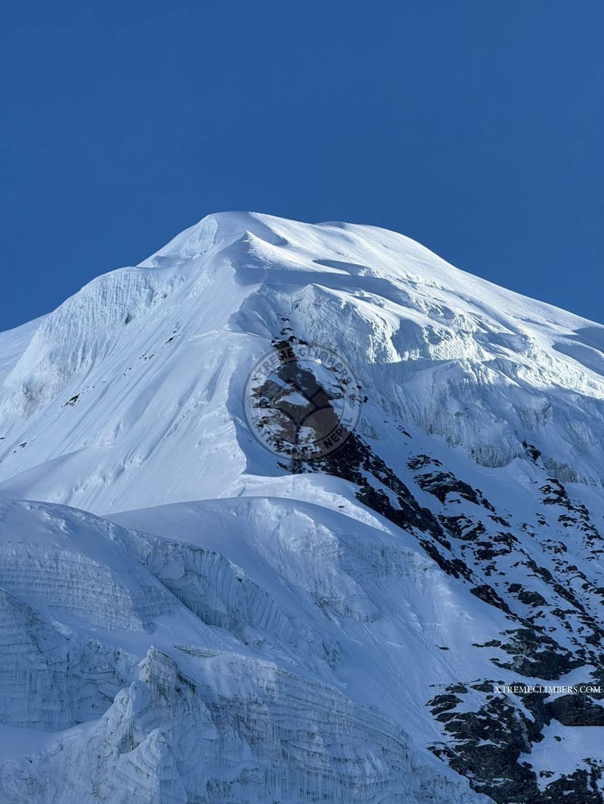
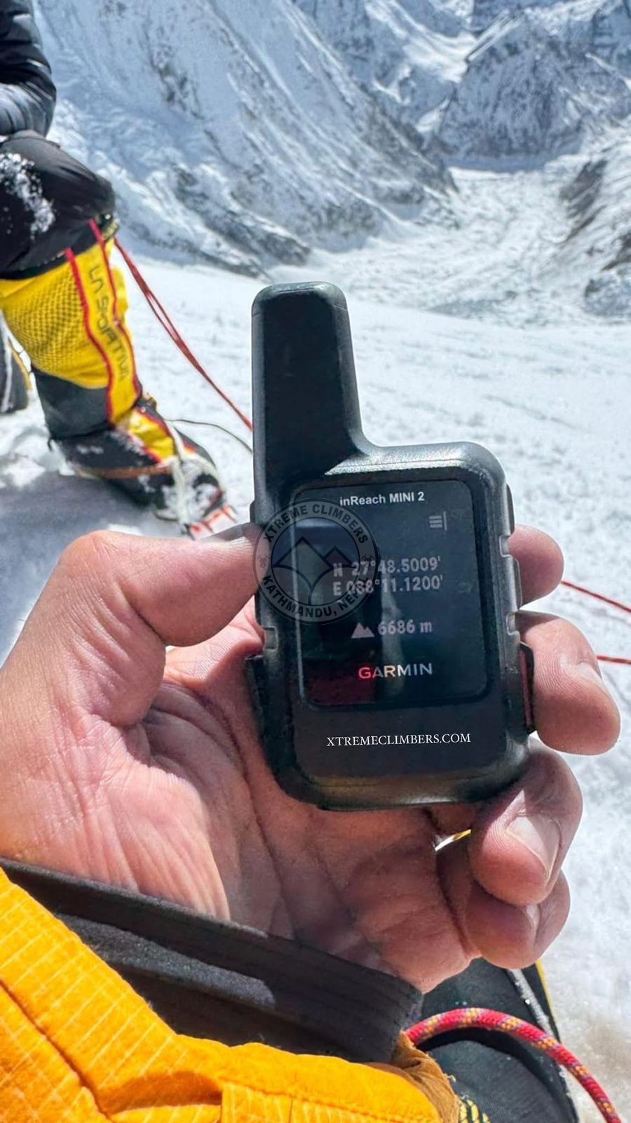
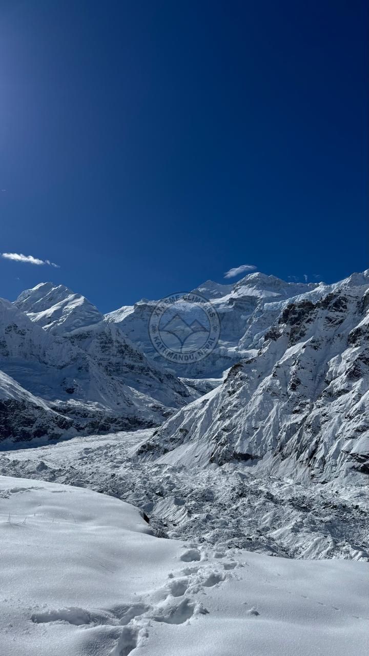
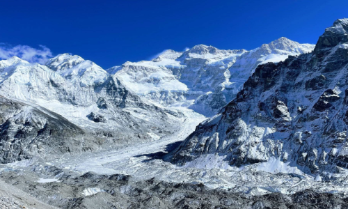
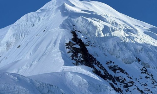
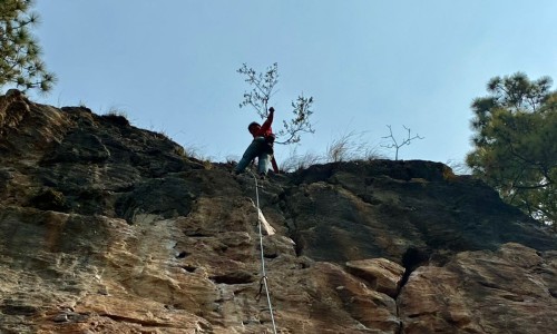
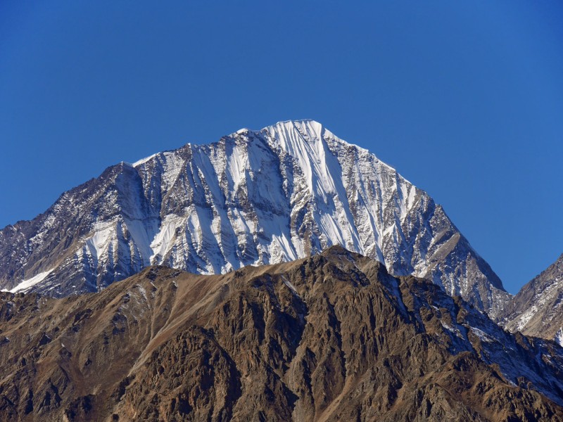
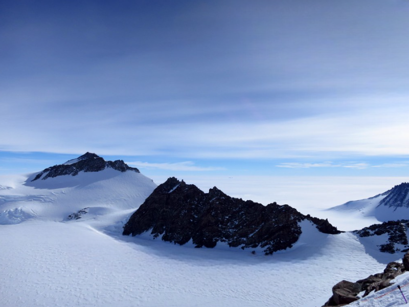
Mount Pathibhara (6,686m), offi cially opened for climbing in 2025, stands in the Kanchenjunga, Taplejung region at coordinates 27°48′5009″ N / 88°11′1200″ E. The team successfully established the route from the South-East Face, overcoming highly technical mixed terrain characterized by loose rock, unstable ice, and exposed glaciated slopes.
𝐂𝐚𝐦𝐩 𝐄𝐬𝐭𝐚𝐛𝐥𝐢𝐬𝐡𝐦𝐞𝐧𝐭𝐬:
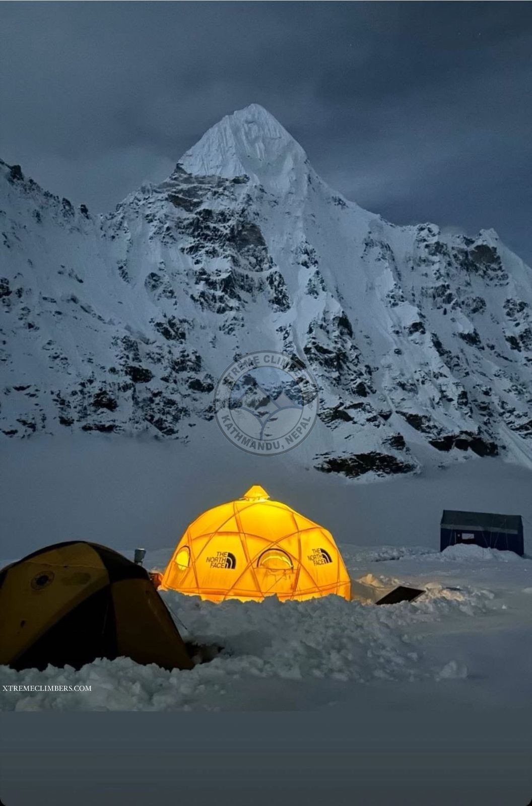
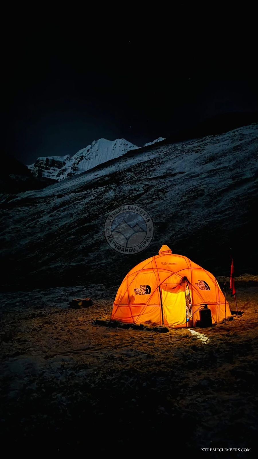
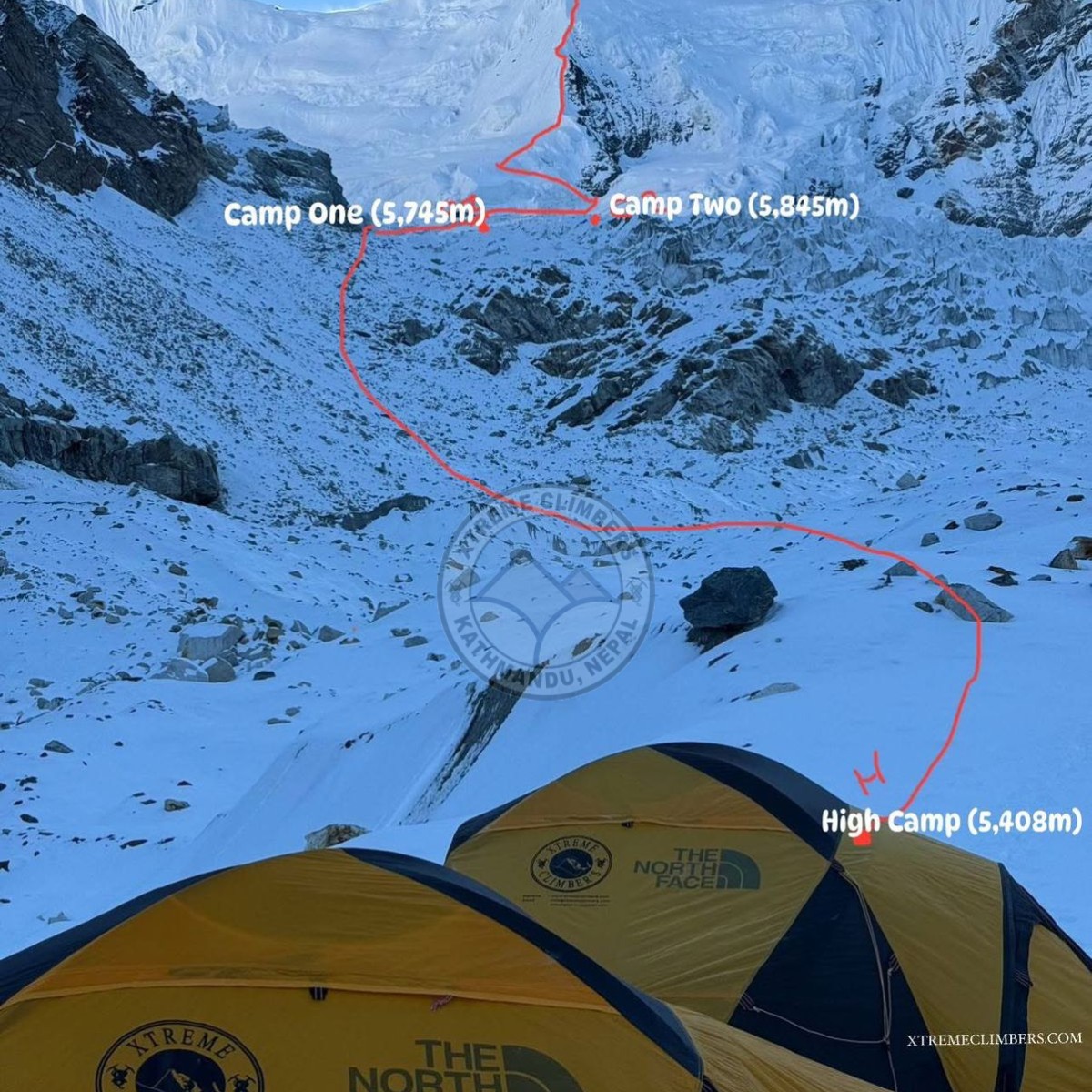
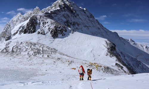
● 𝐁𝐚𝐬𝐞 𝐂𝐚𝐦𝐩 (𝟓,𝟏𝟓𝟎𝐦): Located on a secluded glacial basin; established as the primary operations and acclimatization point.
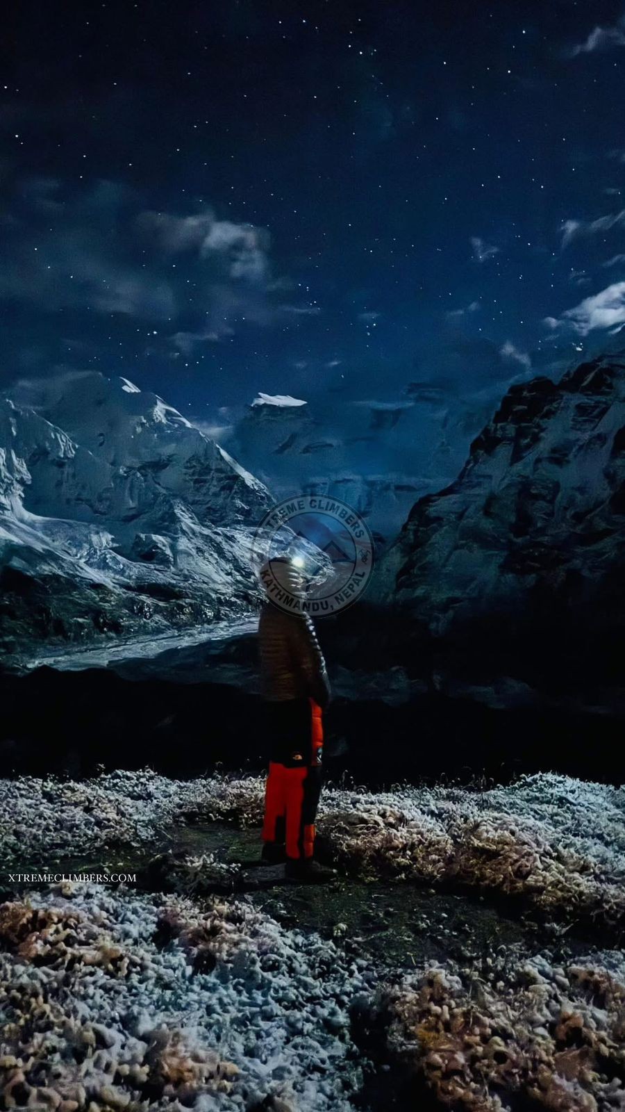
● 𝐇𝐢𝐠𝐡 𝐂𝐚𝐦𝐩 (𝟓,𝟒𝟎𝟖𝐦): Reached after six hours of ascent through steep rockfall zones.
● 𝐂𝐚𝐦𝐩 𝐈 (𝟓,𝟕𝟒𝟕𝐦): Situated on a glacier plateau following a demanding climb across ice ridges and moraine with signifi cant avalanche and crevasse risk (approx. 3 hours from HC).
● 𝐂𝐚𝐦𝐩 𝐈𝐈 (𝟓,𝟖𝟎𝟎𝐦): Set beneath the steepest section of the climb, involving near-vertical ice and mixed terrain with sustained exposure (approx. 2 hours from C1).
● 𝐒𝐮𝐦𝐦𝐢𝐭 (𝟔,𝟔𝟖𝟔𝐦): Reached after 11 hours of continuous technical climbing on mixed ice, rock, and snow ridges classifi ed at TD/7 grade diffi culty. Descent was safely made along the same route using controlled rappels and fi xed-line protection.
𝐊𝐞𝐲 𝐀𝐜𝐡𝐢𝐞𝐯𝐞𝐦𝐞𝐧𝐭𝐬
● ✅ 𝐅𝐢𝐫𝐬𝐭 𝐀𝐬𝐜𝐞𝐧𝐭: First Ascent of Mount Pathibhara (6,686m) via the South-East Route
● ✅ 𝐖𝐨𝐫𝐥𝐝 𝐑𝐞𝐜𝐨𝐫𝐝: Two Himalayan First Ascents (Sharphu IV and Pathibhara) achieved within 7 months
● ✅ 𝐅𝐢𝐫𝐬𝐭 𝐚𝐬𝐜𝐞𝐧𝐭: First ascent on a Himalayan peak newly opened for climbing in 2025
● ✅ 𝐑𝐨𝐮𝐭𝐞 𝐝𝐢𝐟𝐟𝐢𝐜𝐮𝐥𝐭𝐲: Route diffi culty TD/7 – mixed ice, rock, and steep snow terrain
● ✅𝐎𝐫𝐠𝐚𝐧𝐢𝐳𝐞𝐝 𝐚𝐧𝐝 𝐦𝐚𝐧𝐚𝐠𝐞𝐝 𝐛𝐲: Organized and managed by Xtreme Climbers Treks & Expeditions Pvt. Ltd., Kathmandu, Nepal
𝐅𝐢𝐫𝐬𝐭 𝐀𝐬𝐜𝐞𝐧𝐭 𝐓𝐞𝐚𝐦 – 𝐌𝐨𝐮𝐧𝐭 𝐏𝐚𝐭𝐡𝐢𝐛𝐡𝐚𝐫𝐚 (𝟔,𝟔𝟖𝟔𝐦)
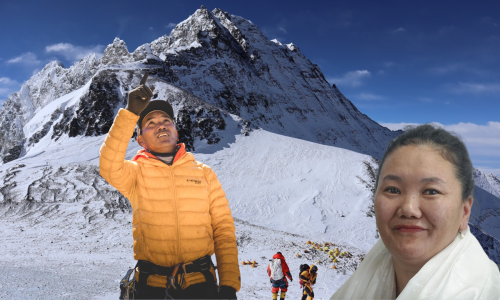
1. 𝐇𝐞𝐫𝐧á𝐧 𝐃𝐚𝐯𝐢𝐝 𝐋𝐞𝐚𝐥 𝐁𝐚𝐫𝐫𝐢𝐞𝐧𝐭𝐨𝐬 (𝐂𝐡𝐢𝐥𝐞)– Expedition Leader & Summiteer
2. 𝐋𝐚𝐤𝐩𝐚 𝐂𝐡𝐡𝐢𝐫𝐢 𝐒𝐡𝐞𝐫𝐩𝐚 (𝐍𝐞𝐩𝐚𝐥, 𝐏𝐚𝐧𝐠𝐛𝐨𝐜𝐡𝐞, 𝐒𝐨𝐥𝐮𝐤𝐡𝐮𝐦𝐛𝐮)– Lead Climbing Sherpa & Co-Summiteer (13+ Everest ascents, multiple 7000m/8000m summits)
3. 𝐋𝐡𝐚𝐤𝐩𝐚 𝐂𝐡𝐡𝐢𝐫𝐢𝐧𝐠 𝐒𝐡𝐞𝐫𝐩𝐚 (𝐍𝐞𝐩𝐚𝐥, 𝐏𝐚𝐧𝐠𝐛𝐨𝐜𝐡𝐞, 𝐒𝐨𝐥𝐮𝐤𝐡𝐮𝐦𝐛𝐮)– Climbing Sherpa (10+ Everest summits, extensive Himalayan experience)
4. 𝐊𝐮𝐧𝐠𝐚 𝐆𝐲𝐚𝐣𝐮 𝐒𝐡𝐞𝐫𝐩𝐚 (𝐍𝐞𝐩𝐚𝐥, 𝐊𝐡𝐮𝐦𝐣𝐮𝐧𝐠, 𝐒𝐨𝐥𝐮𝐤𝐡𝐮𝐦𝐛𝐮)– Climbing Sherpa (5+ Everest summits, extensive Himalayan experience)
5. 𝐏𝐞𝐦𝐚 𝐓𝐚𝐬𝐢 𝐓𝐚𝐦𝐚𝐧𝐠 (𝐍𝐞𝐩𝐚𝐥, 𝐁𝐡𝐨𝐭𝐚𝐧𝐠, 𝐒𝐢𝐧𝐝𝐡𝐮𝐩𝐚𝐥𝐜𝐡𝐨𝐤)– Climbing Sherpa & Expedition Photographer (Multiple 7000m/8000m ascents)
𝐒𝐢𝐠𝐧𝐢𝐟𝐢𝐜𝐚𝐧𝐜𝐞 𝐚𝐧𝐝 𝐑𝐞𝐜𝐨𝐠𝐧𝐢𝐭𝐢𝐨𝐧: This ascent represents not only the fi rst human footsteps on Mount Pathibhara but also a historic dual-fi rst-ascent record accomplished within the same calendar year. It highlights the outstanding collaboration between international alpinists and Nepali high-altitude specialists, emphasizing both nations’ commitment to the continued exploration of Nepal’s newly opened peaks.
As of October 15, 2025, the team is safely descending from Camp II (5,845m) to Base Camp. Technical route data, photographic documentation, and summit verifi cation, including the exact coordinates and summit elevation, will be submitted to the Department of Tourism (DoT), Government of Nepal, and the Himalayan Database upon the expedition’s return to Kathmandu.